SR 70 from CR 29 to Lonesome Island Road PD&E Study
KCA was selected by FDOT District One for the PD&E Study of SR 70 from CR 29 to Lonesome Island Road in Highlands County. For this PD&E study, KCA will evaluate the rehabilitation or replacement of a 4.4-mile segment of SR 70, which serves as an east-west corridor across Central Florida from Bradenton to Fort Pierce. Within the study limits, the SR 70 corridor is classified as a rural principal arterial and is a part of the Strategic Intermodal System (SIS). The existing roadway is a two-lane undivided facility with 10-foot travel lanes and 6-foot (4-foot paved) shoulders. SR 70 is exhibiting severe pavement distress. FDOT conducted a geotechnical investigation and determined unsuitable material beneath the roadbed is likely the cause of the pavement distresses. Segments of SR 70 will need to be reconstructed to remove the unsuitable material to maintain an acceptable pavement condition. The existing 50-foot right-of-way (R/W) width is a key constraint that must be addressed in the study. The narrow shoulders and border area along with the deep canals make reconstructing the roadway infeasible within the existing R/W. As a result, additional R/W must be acquired to reconstruct and rehabilitate the existing roadway. KCA will not only be looking at the reconstruction of the existing two-lane roadway, but will also assess the need for a four-lane divided roadway.
The KCA team is responsible for studying traffic and function, access management, pedestrian/bicycle/vehicular safety, utility coordination, stormwater management, wetlands and listed species assessment, cultural resources, conservation lands evaluation, noise and air, contamination, and public involvement.
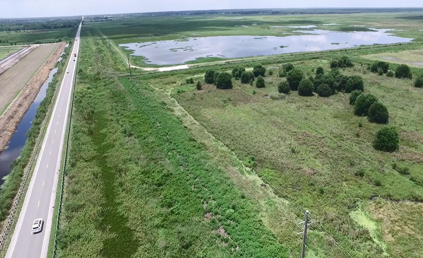
The proposed widening and canal relocation necessitated the creation of a floodplain model to determine possible floodplain impacts of alternative designs and floodplain compensation site sizing. The approximately 70,000-acre watershed hydraulically effecting the project limits was delineated into basins within ArcGIS and then processed within ICPR4 using a No-Rainfall event to test for stability, the historic rainfall from Hurricane Irma to test for validity, and then 2.33, 10, 25, 50, 100-year frequency storms with 24-hr durations followed by 25 and 100-year frequency storms with 72-hr durations to calculate maximum stages. These stages were compared against existing ground elevations within ArcGIS to determine inundation zones. The project analyzed two roadway alignment alternatives each with alternatives for both floodplain compensation sites as well as comparing the effects of off-site stormwater management facilities versus linear ponds. This modeling was able to reduce the R/W needed for the floodplain compensation sites by 30 acres. The results of this model were presented to FDOT for discussion.
Focus Areas
- PD&E
- Public Involvement
- Environmental Services
- Roadway Design
- Traffic Engineering
- Hydraulics Design